François-Xavier Delmonteil PhD defense
Analysis of satellite-based technologies deployment in emergency supply chains

Analysis of satellite-based technologies deployment in emergency supply chains.
Thesis defended on the 21st of December at 1:30pm and it will take place at AX.

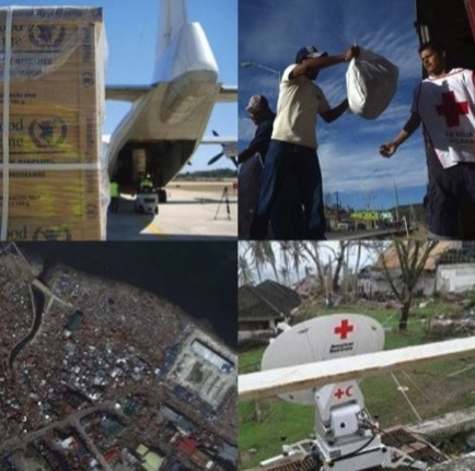
The scale of damage caused by catastrophic disasters is increasing and the provision of aid is becoming more complex owing to uncertain crisis conditions. These issues require the adoption of new alternatives for adapting to dynamic environments and achieving logistics effectiveness in emergency operations. In this context, technology can facilitate the transformation of isolated relief supply chains into coordinated and resilient delivery channels in catastrophic settings. However, terrestrial in situ data collection and communication technologies are not always suitable in the days following a catastrophe because of the geographical scale of damages and the destruction of land-based communication networks. To circumvent these difficulties, relief actors can deploy satellite-based technologies, including satellite imagery and mapping, satellite portable positioning receivers, satellite telecommunications and satellite vehicle tracking.
Despite the increasing importance of satellite-based technologies in relief efforts, fewer studies that describe their roles and limitations in emergency operations have been published. This thesis analyzes the impact of satellite-based technologies in terms of their benefits to emergency logistics and the difficulties in their use. To do so, an empirical study based on the post-2010 Haiti earthquake response period was developed through a questionnaire survey. Field workers involved in emergency operations were contacted and surveyed. To our knowledge, this is the first research specifically dedicated to measure and discuss the benefits of satellite-based information and communication technologies, as experienced by relief workers during an emergency response. The primary findings demonstrate that emergency supply chains can encounter four major logistical challenges: difficulties to assess the needs, logistical bottlenecks, distribution issues and security threats. Most of them can be facilitated by satellite-based technologies. Satellite mapping and communications are useful in the very first days by providing relief teams with a more comprehensive picture of the situation on the ground, which facilitates needs assessment and security management. Portable positioning devices improve needs assessment and distribution management by providing more accurate and near real-time georeferenced data. However, satellite vehicle tracking is not appropriate when responding to an urban disaster and during an emergency response. The results also indicate that the use of satellite technologies has been limited due to the lack of skilled workers and the high costs of satellite telecommunications. The effective dissemination of satellite technologies thus requires more upstream training as well as international agreements. Based on the meaningful information obtained from the case study, we propose a conceptual framework that organizes our findings and highlights the relations between satellite-based technologies and emergency logistics. The grounded methodology provides valuable results and contributes to disseminating strategic and operational insights regarding satellite-based technology implementation and further operational improvements.
Jury:
| Richard Laganier | Professeur, Université Paris Diderot | rapporteur |
| Gilles Paché | Professeur, Université Aix-Marseille | rapporteur |
| Antoine Petibon | Responsable des programmes internationaux, Croix-Rouge française | examinateur |
| Marie-Eve Rancourt | Professeur, Université du Québec à Montréal | examinateur |
| Alain Jeunemaître | Directeur de recherche au CNRS – i3 CRG, Professeur à l’École polytechnique | directeur de thèse |
